Online Property E-Scouting & Map Consulting
Online Property E-Scouting & Map Consulting
Get expert, high-level eyes on your hunting ground—without the thousands spent on an in-person visit.
Whether you're trying to figure out a tough piece of public dirt or want to turn your private acreage into a high-producing trophy farm, our E-Scouting & Virtual Map Consulting gives you a clear, actionable blueprint to transform your hunting success.
What’s Included in Your Consultation
Every map consultation is a collaborative, custom experience tailored specifically to your goals and property dynamics.
1. Comprehensive Digital Map Overhaul
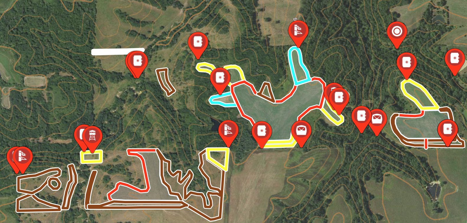
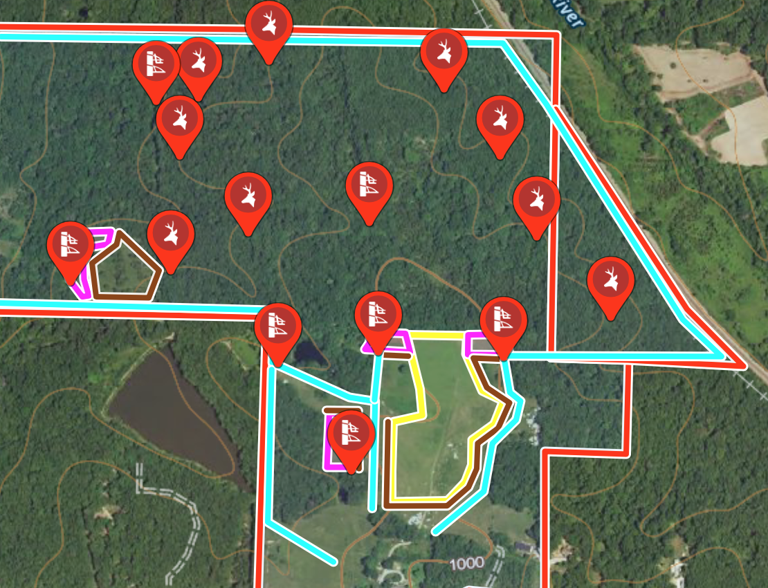
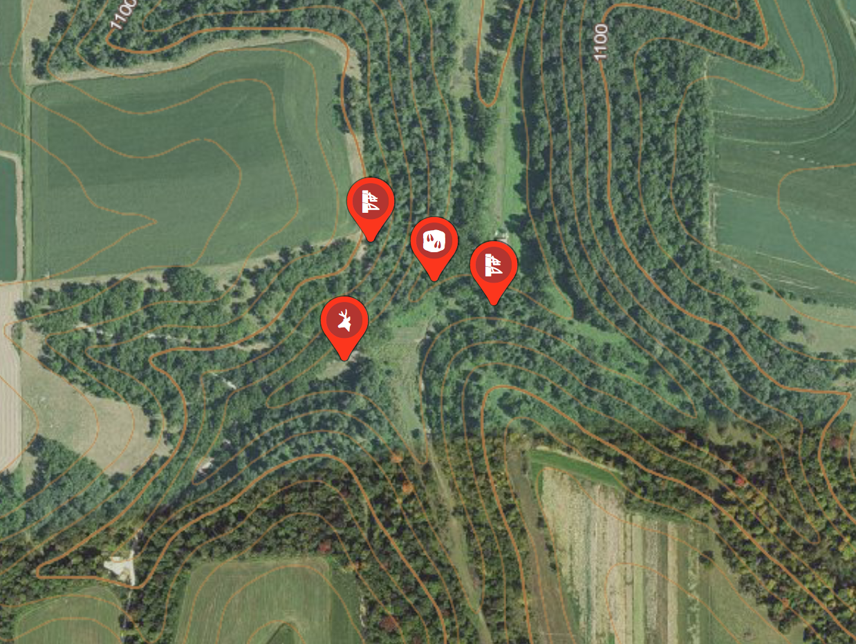
We analyze high-resolution aerial, topographic, LIDAR, and canopy cover maps to build out your property's custom GIS overlay:
Thermal Bedding & Cover Analysis: Pinpointing subtle buck bedding pockets, doe family group bedding, and sanctuary zones.
Movement & Funnel Identification: Mapping out seasonal travel corridors, pinch points, and micro-funnels based on terrain and wind direction.
Strategic Access Routes: Designing low-impact entry and exit paths so you can hunt stand locations repeatedly without blowing out the property.
Stand & Blind Placement: Pinpointing precise setup locations optimized for specific wind conditions and weapon choice (bow vs. gun).
2. Private Land Improvement & Habitat Strategy (For Property Owners)
If you own or manage land and want to maximize its full potential, we provide a complete land-use plan:
Food Plot Design & Staging: Where to put plots, how to shape them to pinch deer into bow range, and customized seed recommendations (what to plant and when).
Habitat Manipulation & Screenings: Blueprinting hinge-cutting/TSI zones, bedding thickets, native grass plantings, and visual screening.
Multi-Year Implementation Roadmap: A prioritized, step-by-step master plan. We outline Phase 1 priorities for Year 1, followed by a long-term strategy you can execute at your own pace.
3. One-on-One Zoom Calls & Direct Access
Initial Strategy Call: We hop on a Zoom call to discuss your property layout, historical deer movement, existing stand locations, and your ultimate goals.
Plan Presentation Call: After analyzing your dirt and building the blueprint, we schedule a second Zoom call to walk you through the custom map layer-by-layer, explaining what to do and why it works.
Ongoing Support: Communication doesn’t end when the call finishes. You’ll have direct personal access to follow up with questions as you implement the plan and track your results throughout the season.
How It Works
Select Your Acreage Tier: Choose the option below that matches the total acreage you want mapped.
Submit Your Coordinates: Once your order is placed, we’ll send you a brief questionnaire to submit your property boundaries and pin locations.
Build & Execute: We build your map, schedule your video calls, and hand over your complete property blueprint!
Online E-Scouting & Map Consulting: Tier & Timing Overview
1 – 50 Acres
Onboarding Zoom Call: 20 Minutes
Blueprint Walkthrough Call: 30 Minutes
Strategy Delivery Window: 3–5 Business Days
51 – 120 Acres
Onboarding Zoom Call: 25 Minutes
Blueprint Walkthrough Call: 40 Minutes
Strategy Delivery Window: 5–7 Business Days
121 – 250 Acres
Onboarding Zoom Call: 30 Minutes
Blueprint Walkthrough Call: 45 Minutes
Strategy Delivery Window: 5–7 Business Days
251 – 500 Acres
Onboarding Zoom Call: 30 Minutes
Blueprint Walkthrough Call: 60 Minutes
Strategy Delivery Window: 7–10 Business Days
500+ Acres / Multi-Tract
Onboarding Zoom Call: 45 Minutes
Blueprint Walkthrough Call: 60+ Minutes
Strategy Delivery Window: Custom Timeline
How the Calls & Process Work
Onboarding Zoom Call:
Goal: Review property boundaries, access points, historic deer movement, and your specific goals (bow vs. gun setups, habitat improvements, food plot preferences).
Strategy Build Phase:
Goal: Trevor conducts deep-dive digital mapping using contour, LIDAR, canopy, and aerial layers to build your custom layout and habitat improvement roadmap.
Blueprint Walkthrough Zoom Call:
Goal: A line-by-line breakdown of your custom map. We present stand locations, bedding thickets, food plot shapes, screening, access corridors, and answer all questions.
Post-Call Follow-Up:
Receive your finalized high-resolution map files/layers, written implementation steps, and direct email/text access for ongoing questions.